Saturday 27 February 2016

Country Road

Views inland to the mountain

crossed lots of rivers in gorges

took lots of photos

Mangaweka

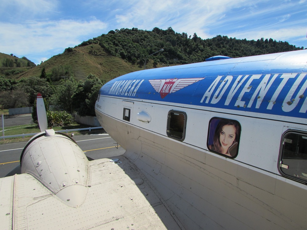
plane café at Mangaweka
On the road north...we are parked at a reserve by a river near Feilding. We took a long loop drive along the 'country road' route - first the Peep-O-Day route to Mangaweka, then back via the Pohangina Valley route. Lots of interesting scenery, steep gorges and windy roads.

Thursday 25 February 2016

Wellington

Part of Peter Jackson's WW1 exhibition

Zealandia

Tuatara

Kaka at a feeding station
We have spent a couple of days in Wellington - always a lot to see! We went to see Peter Jackson's WW1 exhibition yesterday. Also the movies at Brooklyn - love that little theatre. Today we went to Zealandia which is a predator-free valley just outside Wellington city. We did the 2 hour loop walk and saw geckos, tuatara, kaka, hihi/stitchbird, bellbird, n island robin. Nice and sunny here but WINDY.

Monday 22 February 2016

Rivendell

Map of Rivendell

Gnarly old tree

Another big old tree - comes with its own hobbit

At Rivendell
Bit of a lazy day today at Lake Wairarapa but, in keeping with our Hobbit/LOTR itinerary, we went to Rivendell. This part of the movies was filmed in the Kaitoke Regional Park - just over the Rimutakas - so we headed there this afternoon and took a look - also did a loop walk there in bush - lots of very big old trees.

Sunday 21 February 2016

Around Lake Wairarapa

Ocean Beach, Palliser Bay

End of sandbar, flooded

Water gushing out of the sandspit at the Lake Ferry end

Boggy pond

water emptying from Lake Onoke into the ocean
 
 
Today we drove around Lake Wairarapa.  Soouth of the lake the road goes to the coast at Ocean Beach which is pretty rugged with some basic baches.  The base of the sandspit nearby was flooded.  When we drove around to the coast at the other end of the sandspit/Lake Onoke a digger had just cut a channel through the shingle and water was pouring out of the lake into the ocean.  Back at Lake wairarapa we found a walk at some wetlands called Boggy Pond.  This 2 hour walk along a stopbank looks out on...a boggy pond.  They had sprayed all the willow trees so it was a boggy pond with dead trees.

Friday 19 February 2016

Giant Penis

Well that was hilarious - you didn't get the coastal view from the bus but instead got multiple very large pics of a pinnacle that looks like a giant penis.  That photo is not in the draft so I couldn't delete any of them!! 

Cape Palliser

Freedom camping on the road to Cape Palliser
 

About to attempt those steps

Malcolm on the way up

Pretty lighthouse

Me on the way to the pinnacles


amazing scenery

The Lord of the Rings filmed here...

...the paths of the dead

about 1 hour in, half an hour explore and 1 hr return


We are freedom camped near Cape Palliser.  I have had trouble with this website not putting photos in - you may or may not get the view along the coast - or maybe twice or super big??
We drove from Martinborough this morning - I was amazed how beautiful the views from the road were.  Near Cape Palliser it is a bit hairy with washouts and an 'active slip' you drive over.  The lighthouse was cute with its stripes - 254 steps up.
In the afternoon we walked in to the Putangihue Pinnacles.  These eroded pillars were used in The Lord of the Rings movie as the Paths of the Dead.  We were more reminded of Gaudi.


Thursday 18 February 2016

Castlepoint

Castlepoint lighthouse with Malcolm...

...and Heather

typical scenery near Gladstone on road to Castlepoint

Freedom camping spot at Gladstone
We have been having changeable weather lately with rain and sun in the same day sometimes.  We travelled through Tararua visiting Dannevirke and Woodville, though not much Scandi heritage remains.  Drove up the Manawatu Gorge for a look as I'd never been along it before, staying overnight at a freedom spot by the start of the gorge.  Then on to Gladstone which is in a wine-making area between Masterton and Carterton and a bit south.  We drove out to Castlepoint and when we got to the coast we could see an enormous rain cloud front heading our way - luckily the best views were to the south.  We expected to get soaked on the way back but inland the weather got better and better and we had clear blue skies for the afternoon and evening.

Sunday 14 February 2016

Freedom camping near Norsewood

Ormondville station - done up and used as accommodation - you sleep in little railway huts and the platform buildings are kitchen/lounge

Norwegian style carved trolls at Norsewood

Porangahau Beach

Cape Turnagain from Herbertville

Longest place name in NZ and the world

Waihi Falls - not much water going down
We are freedom camped near Norsewood in the Tararua region. Today we did a major (7hour) road trip loop to some remote beach settlements along remote roads. Yesterday we 'did' Norsewood.  The settlements here are named for the Scandinavians who were the pioneers in this region.

Thursday 11 February 2016

Te Mata Peak

part of the track up the hillside at Te Mata Peak


trying to pretend I am not knackered

Malcolm and Kathryn near the summit

yay - the top!!

The way down

lunch at Birdlands

 
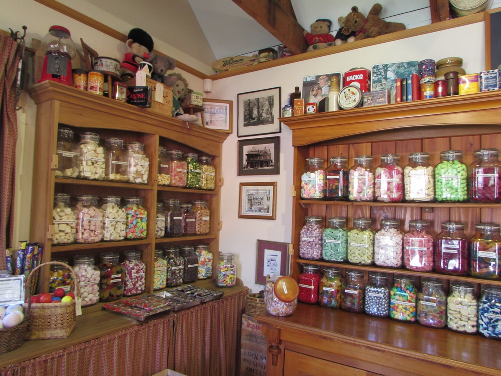
sweet shop at Birdlands


beach walk, Waimarama
Our last day in Napier area. We did a 2 hour walk around and up Te Mata Peak. Why? We thought it was a 1 hr flat walk - well, we hoped it was!!! Actually it was worthwhile, the scenery was stunning - though very hot again, 29 or 30 degrees. We celebrated by having a nice lunch at Birdwoods (you remember that place Jo?) then went to Maraetotara Falls and the beach at Waimarama. After ice cream (seems to have taken over from rum n coke) we drove back to the bus for a wine.