Tuesday, 4 February 2020

Matamata (otherwise known as Hobbiton)

Day 1...


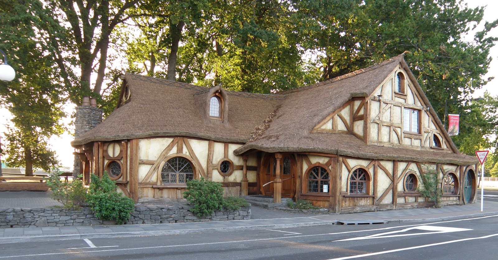
If this building looks like it should be in The Hobbit, that's because Matamata is the nearest town to Hobbiton, where the movies were made.  We visited a few years ago and loved it.  This is Matamata's info centre, where tours go from.


We went to look around the Firth Tower Museum Reserve.  The tower was built in 1882 and is now part of a complex of buildings.  The homestead (above) is adjacent to the tower but is not the original one, that burned down.


Me at the top of the tower

Old phone booth outside the machinery shed


The tower, homestead and other buildings in the background.


Malcolm heading up the tower.  There are exhibits and info on each level.


There's an old church in the background, also an old school...


and gardens, and a woolshed, milking shed, etc.  Lots to see.

In the evening we walked along Centennial Drive, with trees dating back to 1880 though most of it was planted to celebrate New Zealand's centenary in 1940.  Lots of native and exotic trees.


Finally, drinks and dinner at the Horse and Jockey Inn.

Day 2...

We went for a walk to the top of the North Island's tallest waterfall, Wairere Falls.  The track goes steeply up, through bush and over rivers until, after 45 mins you come to a viewpoint where you can see the waterfall...


Then it's up for another 45 mins to the top of the falls.


You come out at this river...


...and walk along to the viewpoint where you can see the top of the waterfall...


Yay!  The top!


On the way down we noticed this reflection in the clear water of the river.


And then we went for a soak in the Opal Hot Springs, followed by a refreshing swim in the pool.


Sunday, 26 January 2020

Another walk- Motukiore Isaland

This walk was in the Whangarei Harbour.  The island is in the middle distance in this photo. The walk starts at Parua Bay and the first part is through a muddy area of mangroves...

...we brought our gumboots.


After the muddy bit the path followed the edge of the mangroves on a sandy, shelly track.

The island is only accessible at low tide when you walk across this shelly spit of land.


There were houses on the island in the past and flowers still bloom in what were the gardens...


This is a panorama from the hilltop, a pa site.

Me walking up the pa (for non-NZers a pa was a fortified hill used by Maori)

Malcolm looking back across the spit of land uncovered by the tide.

Views from the other end of the island, in another old garden.


Another part of the island.  The walk was 2 hours and 10 minutes return.  Worth doing despite the mud.

Saturday, 11 January 2020

Whananaki Coastal Walkway

Today 4 of us walked the Whananaki Coasta Walkway which starts at Sandy Bay.  We went with Elaine and Katherine.

View at the start, the track winds around hills through farmland and along beside the coast.


Malcolm and Katherine were faster walkers

Zoomed in on Elaine and Malcolm along the track which went through areas of native bush.  We had a break (coffee and muffin for me) beside some kauri

We took a side trail to see the Capitaine Bougainville Monument.  The ship was wrecked on the coast here with loss of life.  Very tranquil and peaceful today though.


At the monument

Rather than retrace our steps we went down to the beach and had lunch under some pohutukawa trees


Then it was on to Whananaki.  Behind us is the longest footbridge in the Southern Hemisphere.  We went across into the village and had an ice cream before setting off on the return journey.


Coastal views on the way back

Zoom in on the dots, that's Malcolm and Katherine.  Total distance was nearly 17km.  A good day's walk on a hot day.  We got into the car and headed to Matapouri for another ice cream :-)