Thursday, 19 December 2013

Tikitouring the banks Peninsula

view from our spot behind the Little River tavern

The old railway station at Little River

Malcolm gets his portrait painted by a statue at Akaroa
Malcolm and 'cannibal pot'
 

view looking down on Akaroa


harbour views

where the original lighthouse was at the entrance to Akaroa harbour
 

It was a cold wind
A sunny day with a cold wind.  We went driving around looking at the peninsula.  We drove right to the entrance of the harbour where the lighthouse used to be - as you see on the photos, great views but a very cold wind!  Then we drove back to Little River by way of a 4 wheel drive road - that was 'interesting'.  The pub didn't charge us to stay on the grassy area at the back, just requested our custom.  Sausage and chips was $4 and fish and chips $5 so it didn't break the bank!

Tuesday, 17 December 2013

Banks Peninsula


Governors Bay on the Lyttleton Harbour

Malcolm finds some strange geological features

start of the rail trail

Lake Forsyth

between Lake Forsyth and Birdlings  Flat
Malcolm and sheep

 
Birdlings Flat - once a railway station

on the trail

Lake Ellesmere
 

We are presently camped behind the pub at Little River on the Banks Peninsula.  Today we rode some of the Little River - Christchurch rail trail.  We started at Little River and the trail goes first beside Lake Forsyth.  There were lots of wildflowers along the edges of the trail and in the lake lots of black swans and cygnets, ducks (including presumably blue ducks as it's famous for them) and grebes etc.  Then across farmland at the bottom of Kaitorete Spit and on to the Kaituna Lagoon at the edge of Lake Ellesmere where there were millions of Canada Geese.  Then we cycled back, it took 2 and 1/2 hours and  we felt it the last half an hour.  The weather was great, nice and sunny - a change from the last few days!

We were staying in a motor-home park on the outskirts of Christchurch.  One day we drove to Lyttleton and saw the damage the earthquake had done there.  We were trying to drive round to Godley Head to do a walk but the roads were blocked off whichever one we tried.  So we drove around the harbour instead to Govenors Bay and did a walk on an old carriageway (built by prisoners in the 19th century).

Saturday, 14 December 2013

Back on the East Coast

cliff-top parking spot

view from the bus at  cliff-top parking spot

Cathedral Cliffs

Kereru (NZ pigeon)
Napenape

coastline at Napenape

 
remains of Christchurch Cathedral
the trams are back!


first laundrette I've been in that is part of a café!


We have been camped on a cliff overlooking the Hurunui River mouth and looking up and down the coast.  This is S.E. of Cheviot.  It has to be one of the best views we've had - million dollar ones!  We drove the Gore Bay loop and saw a seal playing in the surf at Gore Bay and the strange rock formations called the Cathedral Cliffs.  Another day we drove around unsealed roads visiting Napenape and Motunau Beach.  Then on to Christchurch where we saw the ruins of the Cathedral and the pop-up mall made from shipping containers.

.

Wednesday, 11 December 2013

Drama and relaxation!!


NZMHA campsite Hanmer Springs

Me at Hamner Springs hot pools - the idea is a photo with the mountains in the background but this is the second time we've been here and Malcolm has missed the mountains off!  Oh well - third time lucky?

We went up Conical Hill which has 360 degree views - this is one of them.

Me on the exhausting mountain climb

Malcolm has lunch at the waterfall - its drop is 41 metres
This first part is for all those working and/or in the northern hemisphere winter who think that we are just cruising around without a care in the world!  Just to show it's not all fun and games....

We left Greymouth feeling a bit glum because of the bad recent weather and how much we have had to spend on the bus lately.  Just past Reefton heading towards Lewis Pass there was a loud bang which turned out to be a puncture on one of the back tyres.  We unhooked the car so as to make less weight etc and drove along looking for a place to turn around.  Malcolm attempted a 3 point turn but the back wheels stuck on the soft shoulder and he couldn't get the bus  to move forward.  So the bus was blocking 1 and 1/2 lanes of road!!!  I had just seen a truck and trailer roar past so was scared that something would plough into us.  I drove the car up the road to the next bend (not far) with the hazard lights on and before long we had several vehicles helping us.  finally a grunty ute towed us clear and I ran back to the car and followed Malcolm back to Reefton, where even though it was past 6.00 pm the tyre guy came immediately and changed our tyre for the spare - as it was better than the retread he had.  So no harm done really - just stressful!!!  We drove on to the top of Lewis Pass where we spent the night.  First thing we did was pour big rum and cokes!!

Next morning a truck tooted us.  Malcolm looked out and he was tossing the morning paper our way.  So we read the paper over breakfast, then headed down to Hanmer Springs where we had a bit of relaxation in the hot pools.  The weather got better and better and the next day we did two walks.  One was a waterfall walk which was 2 and 1/2 hours - basically 1 and 1/4 straight up vertically!  Down was easier.

Sunday, 8 December 2013

Grey Greymouth


On the coast road between Westport and Greymouth

bus n bush

On the walk to Elizabeth Point, looking back towards Greymouth

some blue sky after 3 days of rain - Elizabeth Point

at the Brunner mine memorial
the Brunner mine area in misty cloud, note brown river!
 

World famous in New Zealand - 'formerly' the Blackball Hilton
We have spent a few wet days in Greymouth - I guess you always get rain on the west coast sooner or later!  We couldn't leave though, as the bus was booked in on Saturday for its COF.  Then it needed work doing on the brakes so we had to wait for Monday for them to do that.  Unfortunately they needed to sent do Christchurch for parts so we moved out into a TopTen holiday park unit.

When we (finally) got some sun at the weekend we walked to Elizabeth Point which gave views up and down the coast.  Today we went to the Brunner mine site which is a memorial to the miners who died there and is also a historical place to wander around and find out about.  Then we went to Blackball which is as off the beaten track as we expected.  We also had a good look around Greymouth museum which is of the old sort and has heaps of stuff, especially about gold mines, coal mines, pioneers of the coast and floods.

Wednesday, 4 December 2013

Oparara Valley


Moss World
 
reflections amidst the moss

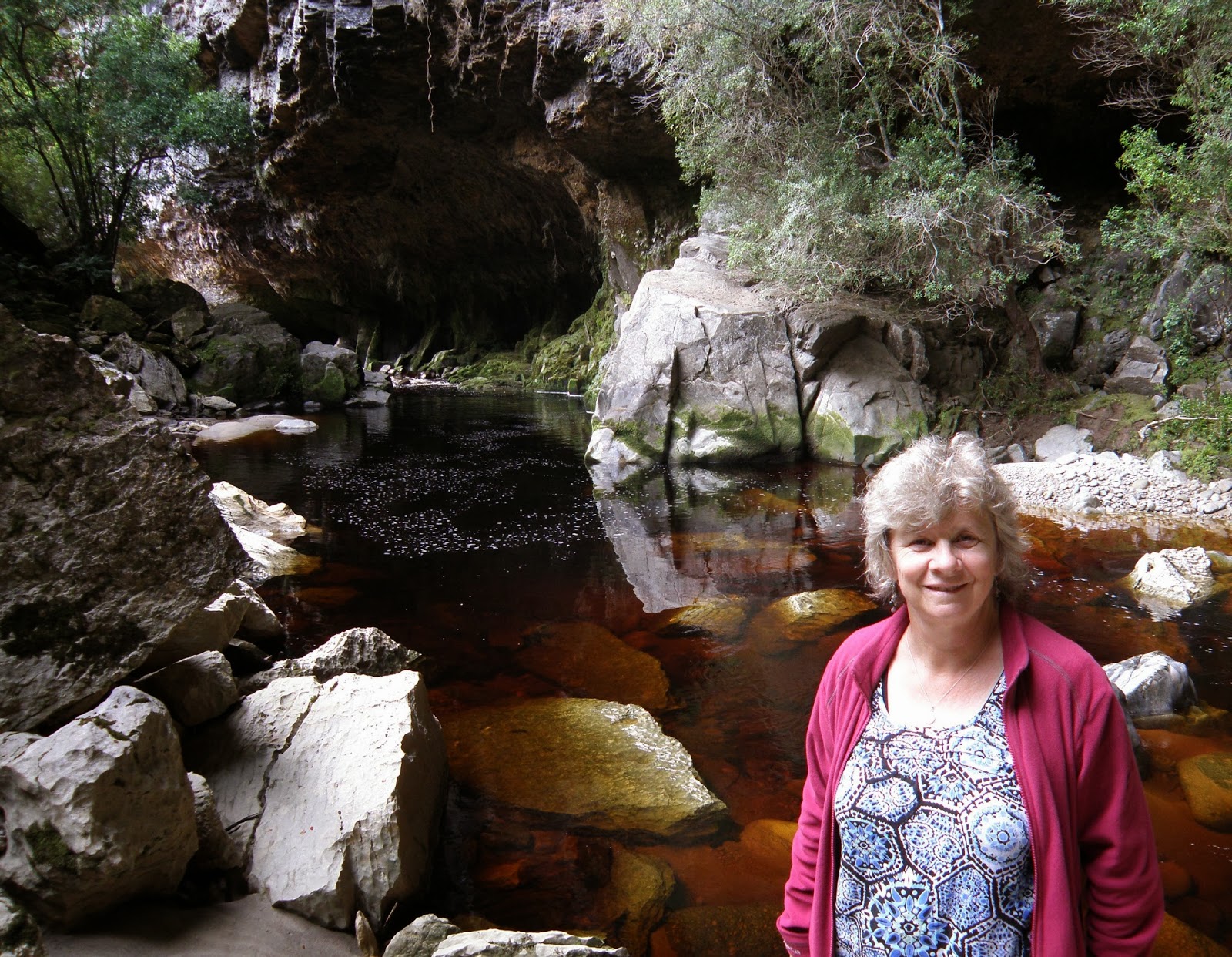
Me at the Oparara Arch
me in a side tunnel in Box Canyon Cave - it was pitch dark but this is what the flash on Malcolm's camera revealed

Nikaus at the start of the Heaphy


South Island Robin

Malcolm near the start of the Heaphy Track
Today we went to Moss World.  We freedom camped for 2 nights at the ruins of McCallum's Mill on McCallum's Mill Road which leads inland, north of Karamea.  16 kms further on there are some walks in the ferny forest.  The big trees are totally covered in moss, there is moss all over the vines that grow on the big trees, there is moss on the stumps of trees, the rocks and cliffs, everything!  I think if you spent too long taking a photo the spores would take hold on you!  Anyway we went to look at the Oparara Arch, the Southern Hemisphere's biggest rock arch (43m high, 50m wide, 219m across) because we forgot we'd been there before!  This time we had torches and went right through it, looking at the stalactites and stalagmites. 

Then we went further up the road to 2 caves, the Box Canyon and the Crazy Paving caves.  The crazy paving is quite low with a floor made up mud deposits that have dried into large slabs (you just walk up the middle on a walkway).  saw some wetas but just little ones!  Box Canyon Cave is much bigger and you go down a staircase to get inside.  It is big and dark with mazy side tunnels.  Malcolm had a headlight and torch so could illuminate things quite well, I had a feebler torch.  When we turned them off it was pitch black.  Very silent and dusty, you could see the dust rising in the torch beams.

We had lunch in Karamea at the last Resort (good name!) then drove as far north as you can go, Kohaihai at the start of the Heaphy Track.  We walked a little of the Heaphy - well I admit a very little -  just 1/2hr in to Scott's Lookout and a 40 min loop among Nikau and Rata (just starting to flower red).

We bike Charming Creek Walkway


Anyone want to buy a house in Seddonville?

old machinery on the walkway

Heather in action

Malcolm carries the bikes over a slip

the waterfall

Malcolm rides over a swing bridge
 

We finally got our bikes off the back of the car and had a ride along the Charming Creek Walkway.  It is (the name is a clue) actually a walkway but the publican at Seddonville said people bike it.  Since it was a 5 and 1/2 or 6 hour return walk we decided to bike it as this would be quicker.  It was - it took us 3 and 1/2 hours and I was pretty tired afterwards - haven't been on the bike for ages.

The track is mainly along the route of an old railway but they didn't take away the sleepers.  So for quite a bit of it, it is bumpy!  Interesting though - with relics from gold mining and saw milling days and a few sheds with information boards in them.  Towards the end of the track we came to a slip and Malcolm had to carry the bikes over it.  Then some big overhangs and a long tunnel before coming out by the waterfall.  It was pretty impressive, set in the bush covered mountains and only us around.  Just after that we met 2 DOC guys and told them about the slip, plus 2 other people walking in from the other way.  The way back was slightly uphill and I was glad to get back to the car.  Worth it though!